The View From 1983:
The history of planning for the station is linked to the history of downtown Rockville, the first community in Maryland to undertake a federally supported urban renewal program. Urban renewal replaced the old retail core of Rockville with a large, unusual mall structure [The Commons – Rockville Mall] which has been a commercial failure.
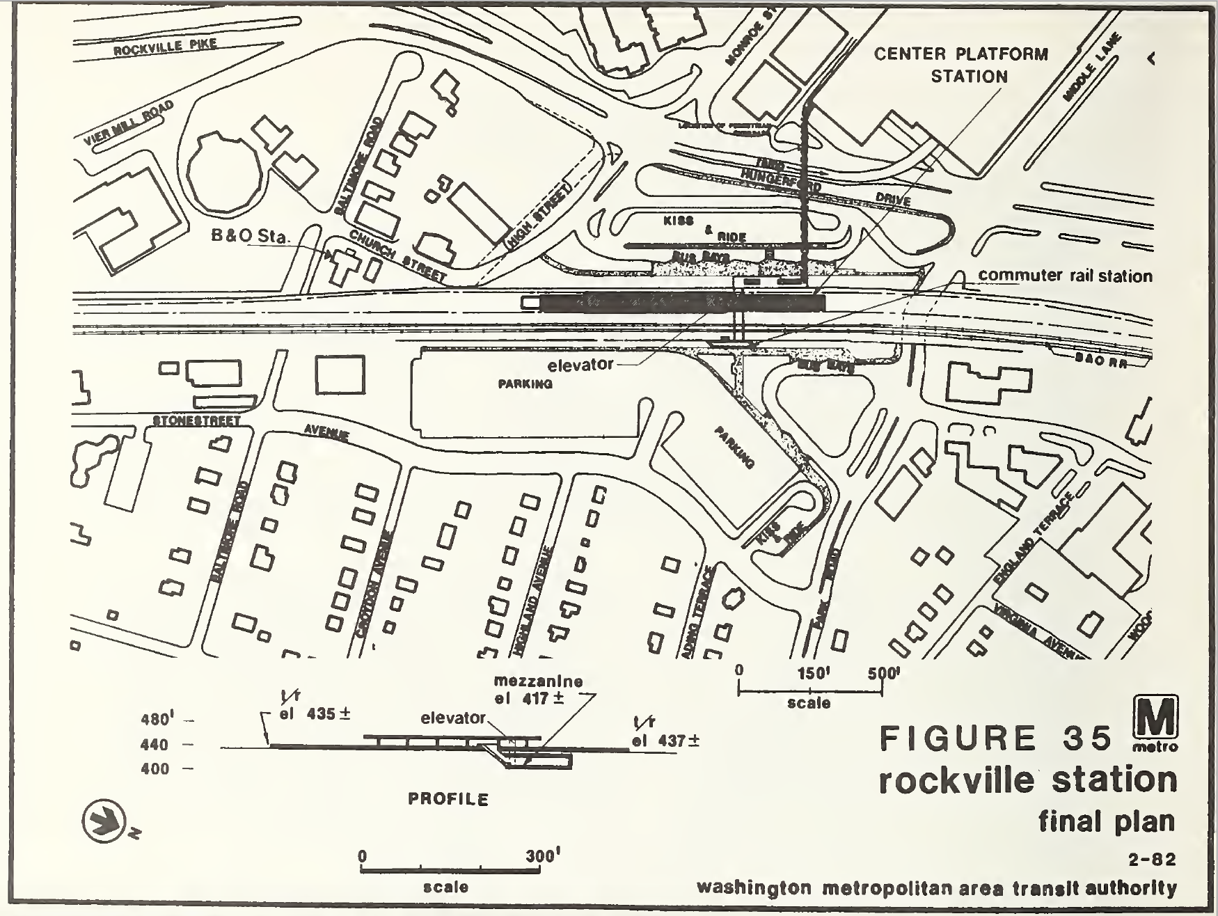
The railroad and Metrorail alignments restrict access to the east. Large surface parking lots in the existing CBD isolate land uses, promote automobile dependency, and create an unattractive visual environment.
The current subway plan first adopted in 1968 again placed the northern terminus of the transit corridor at Rockville along the B&O Railroad. A car storage and inspection yard associated with the 98-mile system's Rockville terminus would have created massive community impacts, hence the terminus and yard were moved several miles north to create the plan for a 101-mile system.

ADDITIONAL CASE STUDIES:
District of Columbia. Anacostia, Farragut North + Farragut West, Gallery Place + Metro Center, Navy Yard, Rhode Island Avenue, Takoma.
Maryland. Addison Road, Friendship Heights, New Carrollton, Rockville, Silver Spring.
Virginia. Ballston + Court House + Rosslyn, King Street, Huntington.
EXCERPTED FROM:
These observations were compiled in 1983 by the Metropolitan Washington Council of Governments, a group of 300 area-politicians that currently self-identifies as “the hub for regional partnership.” Within the context of 1980’s Metro history, transit author Zachary Schrag has described the group as essentially “a forum for intergovernmental discussions,” without direct impact on policy.
Read the full text below. “Metrorail Station Area Planning, A Metrorail Before-and-After Study Report,” by Metropolitan Washington Council of Governments. August, 1983
Metrorail Station Area Plan... by Elliot Carter on Scribd